Skip to content

Calcasieu-Sabine

History

The site, started in 1999, is a marsh creation project that utilizes material dredged from the Calcasieu River Ship Channel. The project is part of CWPPRA (Coastal Wetlands Planning, Protection, and Restoration Act. It is located on the Sabine National Wildlife Refuge in a large, open water area northwest of Brown’s Lake. The material that is removed from the ship channel is pumped into the sites and placed in locations around the basin to artificially regrow the marshland. The purpose of this project is to create new marshland to replace what was lost from erosion and salt water incursion. The site has created 462 acres of intertidal emergent marsh by using 4.6 million cubic yards of sediment dredged from the Calcasieu Ship Channel. Its future goals are the creation of an additional 230 and 232 acres of brackish marsh platform. The implementation of earthen dikes to contain the dredged material. To de-water the marsh creation disposal area and to create fringe marsh with the overflow. (Coastal Information Management System, 2020)

Tour

We visited the Calcasieu-Sabine Basin Project on February 24th, 2023. The site was located on the right side of LA 27, a lengthy road that runs to the west of Calcasieu Lake.After crossing a small bridge, the public-facing side of the restoration project could be seen ,consisting of a boat launch and fishing bank. From the bridge, we could see the marsh extending out from the bank on one side and a shipping canal cutting across marshland on the other. Perpendicular to the bridge is a massive channel of water that is stopped from going onto the road by rocks placed on its banks. Boat tailed grackles and a single red-winged blackbird flew all around as mosquitoes buzzed across the location. Throughout the entire visit, dump trucks could be seen transporting material such as dirt and rock from locations up north to coastal areas down south. At a glance, it seemed as if the site existed upon an island that was cut off from the mainland. Many of the trees in the area appeared unhealthy and leafless with only smaller types of vegetation being present. Off in the distance, the tall towers of the Calcasieu refinery could be seen. The site allowed for some fishing and leisure for visitors, but it did not appear to receive much recreational use from the locals with litter being the only indication of some use at all.

Expert

The Calcasieu River ship channel, constructed in 1942 for the purpose of allowing shipping from the Gulf of Mexico to Lake Charles, runs from south of Cameron up to Lake Charles.  This has resulted in loss of marshland on both sides of the ship channel from salt water intrusion. Furthermore, wind driven waves and wakes from the ships have further contributed to the erosion of the banks. This project consisted of 5 cycles and was approved in 1999. The purpose of cycle 1 was to place maintenance dredging from the Calcasieu River ship channel into this area to help build wetland in the large open water  area of the interior marsh. The dredged sediment also reduced the distance that waves could travel both from the ship channel and the coast, preventing further erosion. The project was a partnership between the U.S Army Corp of Engineers, the Coastal Protection Restoration Authority of Louisiana and the U.S. Fish and Wildlife Service. After the success of cycle one, it was decided that putting in a permanent pipeline from the ship channel would reduce the cost of moving the sediment and so it was decided that this would be the purpose of cycle 2. The purpose of cycle 3 was to build up the marsh to the south , while cycles 4 and 5 would build up the marsh  to the west and east.

Interview Findings

While the community wants to see this project succeed, as it could lead to a rejuvenation of the local area, the community members have their doubts and concerns. Their primary concern is that hurricanes, starting with Rita, destroyed much of the project gains made from 1999 to 2005. This has resulted in some community members feeling as if the projects will not be enough to keep up with the rate at which marshland is lost. Some community members expressed that they thought the project was more of a reactionary step rather than a proactive one, explaining that the project was unviable so long as issues closer to the coast are not resolved. Others advocated for levees instead of marsh creation.

“You know, you have to stop it at the coast before we spend billions of dollars trying to restore something, then the next storm comes right over it and destroys everything we have done.” 

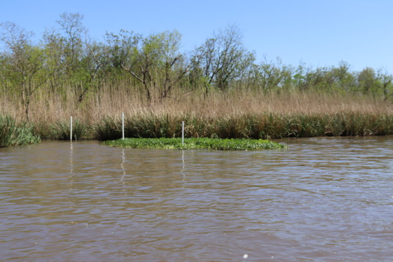
  There were also concerns over whether or not the material being dredged was being tested for contaminants as reports of a black sludge along some properties was discovered. Some community members believe this may be attributed to the dredged material being used in the sites and that this may explain the death of local wildlife particularly that of fish.

“The contamination in the Calcasieu River, The whole river complex is contaminated with PCBs, vinyl, volatile organic compounds and all kinds of stuff. It’s just it’s there”.


“There are fish advisories all up and down the river, and they’re taking that sediment that’s washing up in here and filling in the ship channels. So I would ask, well, how much environmental testing do you do with the sediments?”


One member who has some experience with coastal restoration efforts, discussed his attempts to garner support for restoration sites. One of his concerns was community outreach and participation. His opinion was that by giving private donors firsthand experience with coastal restoration, continued cooperation could be facilitated between the community and the restoration projects which could result in positive outcomes for all. 

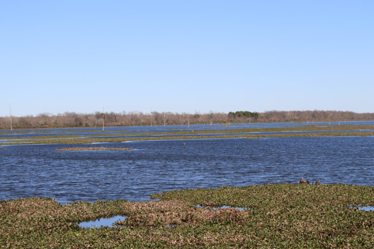
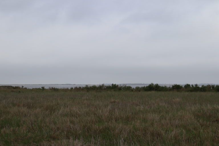
The community members admitted that the project was successful in restoring some resemblance of the marshland that the community members remember from their childhood. They expressed that the area’s ecosystem had changed over their lifetimes and that species of animals and vegetation that used to be prevalent were no longer. Since the start of the project, some of these species have been spotted more frequently.  According to one community member, the site has been particularly successful in restoring habitat for native fish and oysters. However, there are concerns over the longevity of the projects being damaged every time a hurricane comes through. The damage caused by these hurricanes and storms has also resulted in massive spikes in flood insurance for the area which is greatly concerning for the community members.

“My mother grew up on Lake Charles Lake and there were cypress trees. There are pictures of me and my mother and her cypress trees that were all on the outside edge of Lake Charles Lake, and they were all dead. My dad told me that when he was a kid, this was way back when they were first building this thing. He said that there was nothing but cypress trees all over Lake Charles Lake, all down the ship channel.”

“We have seen fisheries decline globally, and Louisiana is no different. So, we want to make this better. In my mind one way of doing that is to bring oysters back as a habitat. Oysters are unique in that they are a commodity, but also a habitat, like salt marshes or seagrass or mangroves”

Conclusion

Overall, the community members interviewed that day did not have confidence as to the viability or sustainability of the project and this may be a result of insufficient community outreach. By creating new marshland it has allowed for some of the natural ecosystem to return. Species of animals such as the black rail have begun to be return to the area and while the community members express concerns over the viability of the project it has resulted in some positive benefits.  One of which has been the creation of 462 acres of intertidal emergent marsh by using 4.6 million cubic yards of sediment dredged from the Calcasieu Ship Channel.